Drones & Roof Inspections

When you normally think about having a roof inspection, you likely think of ladders at least and scaffolding at worst.  A human being has to climb on up to the roof with all of the health and safety considerations that this incurs, not to mention the potential for damage to the roof itself during the inspection process.

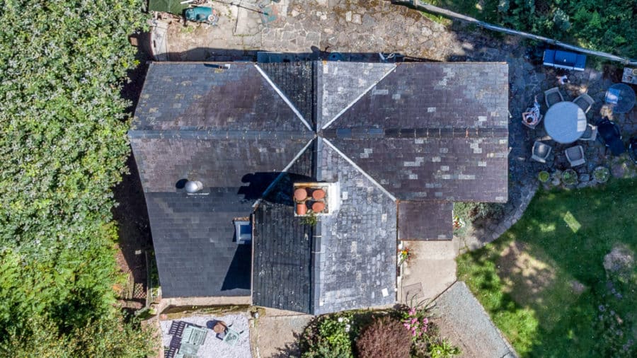
Drones carrying both standard and thermal cameras offer you the opportunity to carry out a thorough and detailed inspection of the roof from all angles with minimal human intervention – minimising the time, set up and safety risks of traditional inspection methods.  Provided that the inspection can be carried with the landowners permission (required for the takeoff and landing site of the drone) the UAV can fly over the roof both recording what is there and also providing live flight data to pinpoint areas for closer or further inspection.  Maintenance teams can then be deployed in a targeted way to problem areas if required, making a cost saving and minimising any disruption.

Whilst you are having a standard roof inspection flight, you might also consider having a flight with our drones carrying our state of the art thermal imaging camera.  One service fee but with twice the amount of data – a thermal imaging flight will allow you to scan for heat loss and problem areas that may not even be visible to the naked eye.  This allows you fix and maintain your roof in advance of serious problems occurring which could save both time and money.

Leverage the power of the drones to make inspections quicker, safer and more cost effective.

#inspection #roof #thermal
Drones & Roof Inspections


#inspection #roof #thermal


https://www.dronemediaimaging.co.uk/drones-roof-inspections/

Comments

Popular posts from this blog

Product Photography Opus Genie Wipes

​ https://www.visualchaosstudios.co.uk/product-photography-opus-genie-wipes/

Forest Canopy Survey Using Photogrammetry Techniques

Caterham School Photogrammetry of Forest Trees - Surveying for Chalara Fraxinea – Ash Dieback Last year, we were asked by Caterham School to survey and map their school forest known as Old Parks Wood. Ash trees within the wood were suffering from Chalara Fraxinea (Ash Dieback) a disease which has the potential to kill off 80% of the ash trees in the 45-acre wood and once dead, would quickly become dangerous to wildlife and other users of the woods, including the school pupils. The mission was to map the forest canopy by drone using photogrammetry survey techniques so that the school could get a full understanding of the degree of diseased trees that were present, and then subsequently put in place a management plan in conjunction with the Forestry Commission, Natural England and the local council. Project Background In 2014 the school had bought approximately 140 acres of Old Park Wood – partly to protect it from the threat of development but also to secure its long-term future as a bi...

Hidden Issues with Thermal Imaging During Building Surveys

Beyond the Surface: Discovering Hidden Issues with Thermal Imaging during Building Surveys Building surveys have evolved significantly, thanks to advancements in thermal imaging technology and the transformative impact of thermal imaging during building surveys, uncovering concealed issues that traditional methods might overlook. The Power of Thermal Imaging Thermal imaging enables a deeper understanding of a building’s thermal performance. By capturing infrared radiation, these cameras reveal temperature variations that are invisible to the naked eye. This non-destructive technique is particularly valuable for identifying hidden issues affecting a building’s efficiency and structural integrity. Harnessing thermal imaging technology during surveys provides a comprehensive overview of a building’s insulation, HVAC systems, and potential air leaks. This proactive approach goes beyond the surface, allowing for precise problem detection before they escalate. Unearthing Insulation Deficie...