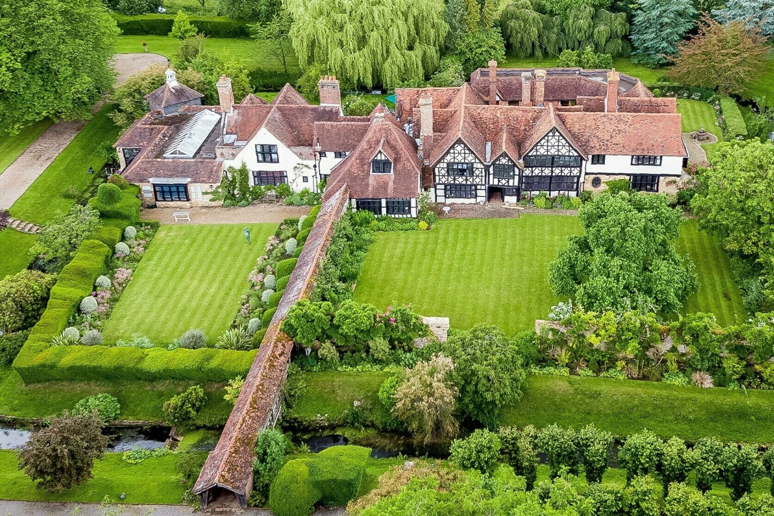
Simple Aerial House Portraits

Simple Aerial House Portraits


The Perfect Gift – House Portraits with Drone Property Photography

There has never been a better time to get your house photographed! Whether you are buying as a gift for someone else, or you have always wanted to have a framed photo of your home from the air, using a drone photographer now makes the process so much easier and cheaper.

It wasn’t that long ago that you had to get in touch with manned aviation who used a photographer to photograph your property from above 500ft, without the opportunity to get great low shoots or from various angles to pick from. Instead, you had to wait until the manned aviation company were in your area or more specifically your airspace, and then you just had to accept what they shot. With aerial photography shot by drone you are in contact with the photographer on the ground, and can even review the images before they leave to ensure you have what you want.

Drones can operate much closer to your home than manned aviation and so the perfect shot angle is more achievable. Here at Drone Media Imaging, we can also add video clips, which are a great addition should you be marketing your property for sale either through an estate agent or if you are selling directly yourself.

We offer a set price for photography and/or video, get in touch for more information, or use the link to book directly online.

#aerialhousephotography #dronehousephotography #dronerealestatephotos #propertyshotfromtheair


https://www.dronemediaimaging.co.uk/simple-aerial-house-portraits/

Comments

Popular posts from this blog

Product Photography Opus Genie Wipes

​ https://www.visualchaosstudios.co.uk/product-photography-opus-genie-wipes/

Forest Canopy Survey Using Photogrammetry Techniques

Caterham School Photogrammetry of Forest Trees - Surveying for Chalara Fraxinea – Ash Dieback Last year, we were asked by Caterham School to survey and map their school forest known as Old Parks Wood. Ash trees within the wood were suffering from Chalara Fraxinea (Ash Dieback) a disease which has the potential to kill off 80% of the ash trees in the 45-acre wood and once dead, would quickly become dangerous to wildlife and other users of the woods, including the school pupils. The mission was to map the forest canopy by drone using photogrammetry survey techniques so that the school could get a full understanding of the degree of diseased trees that were present, and then subsequently put in place a management plan in conjunction with the Forestry Commission, Natural England and the local council. Project Background In 2014 the school had bought approximately 140 acres of Old Park Wood – partly to protect it from the threat of development but also to secure its long-term future as a bi...

Hidden Issues with Thermal Imaging During Building Surveys

Beyond the Surface: Discovering Hidden Issues with Thermal Imaging during Building Surveys Building surveys have evolved significantly, thanks to advancements in thermal imaging technology and the transformative impact of thermal imaging during building surveys, uncovering concealed issues that traditional methods might overlook. The Power of Thermal Imaging Thermal imaging enables a deeper understanding of a building’s thermal performance. By capturing infrared radiation, these cameras reveal temperature variations that are invisible to the naked eye. This non-destructive technique is particularly valuable for identifying hidden issues affecting a building’s efficiency and structural integrity. Harnessing thermal imaging technology during surveys provides a comprehensive overview of a building’s insulation, HVAC systems, and potential air leaks. This proactive approach goes beyond the surface, allowing for precise problem detection before they escalate. Unearthing Insulation Deficie...