Solar Farm Thermal Inspections - Effecient Solar Farm Maintenance Practices
Drone Media Imaging offer solar panel inspections using state of the art thermal cameras and qualified thermographer Level 2 pilots. This means that we are almost uniquely placed amongst drone operators to guarantee data collection under the correct conditions and meaningful reports that identify any faults or anomalies. Add to this the enhanced flight operating permissions we have been granted by the CAA, puts in in a very small exclusive group in the UK.
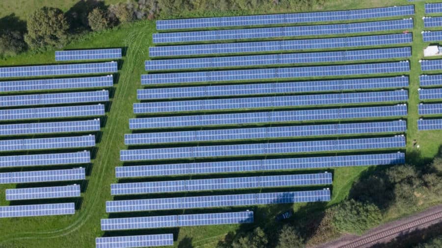
An aerial inspection is an ideal method of assessing the condition and performance of all solar panel arrays when compared to manual ground-based inspection techniques. The advantage of an airborne camera is particularly acute when panels are in areas that are difficult to access or cover large areas, such as solar farms.
Using dedicated mapping software, the drone flies a pre-programmed route or mission which allows large areas to be inspected quickly and efficiently. Any faults or anomalies that are then identified are then reported along with their exact location so maintenance teams can be deployed to exactly the right spot to carry out repairs or replacements. This means that the cost of inspections can be significantly reduced, and panels kept running at optimum levels for longer. Estimates of the reduction in inspection time are as high as 90% when using drones as compared to manual ground-based teams.
Solar panel inspections are recommended following completion of new installations. This means that any manufacturing, PID or installation errors can be immediately identified and remedied under warranty before signing off with your installer.
Drone thermal inspections are also an important tool when negotiating the purchase of existing solar installations. An accurate map of the solar field is a valuable tool for the seller to show how well maintained and functioning the panels are. When the inspection is being carried out on the part of the purchaser, or new operator, an accurate picture of performance can be an excellent negotiation asset.
The simplicity of drone based thermographic solar farm inspections means that they can be routinely scheduled to compare year on year performance and keep on top of any faults as they develop before, they cause a loss in performance.
Contact Drone Media Imaging to discuss your requirements and maximise your solar investment.
#dronethermalimagingatsolarfarms #solarfarmmaintenance #solarfarmthermalinspections #solarfarmthermography
https://www.dronemediaimaging.co.uk/solar-farm-thermal-inspections/
Comments